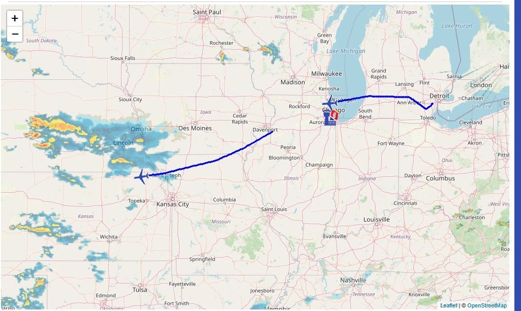
Something i have been working on with a friend lately is creating a flight path line from the flown route on v5.5.2
This is still the early stages but everything is already there thats needed. when i do the corrections and other fun stuff to the code i will put it out. check it out for yourself.
This is without the addons that cost $$$ and made with everything already given to you (but with leaflet)
leaflet will be required to run this as im not paying $$$ for a google maps API
So lets Continue on
First thing is first, we have to make a db from your mysql
CREATE TABLE [name of your table] ( id INT AUTO\_INCREMENT PRIMARY KEY, flightnum VARCHAR(255) NOT NULL, timestamp TIMESTAMP NOT NULL DEFAULT CURRENT\_TIMESTAMP, lat DECIMAL(8, 6) NOT NULL, lng DECIMAL(9, 6) NOT NULL );
you can name yours whatever. this is where you will store all of that flight lat and lng. Im still working on the code to grab that data for a selected flight but might as well start you on the MYsql side..
I wouldnt recommend doing this if you have little experience with MYSQL and adding into the DB