
Nabeel
-
Posts
8151 -
Joined
-
Last visited
-
Days Won
39


About Nabeel

Recent Profile Visitors
98855 profile views


Nabeel's Achievements
")


-
Turns out to be some server misconfiguration
-
It could be onedrive causing the issue with loading. Data gets stored there, too, which the onedrive sync can sometimes conflict with. I'd recommend deleting the profile files or everything in documents/vmsacars and starting fresh But before you do that, if you can send me the profile file over Discord (just DM me), I can also debug to see if I see the same behavior on my end.
-
Hey, The answer is... sort of. For the current stable and beta versions, you need to have MSFS2020 installed, for the scenery. If your scenery is already scanned, then hit start and SimConnect should "just work". I'm working on the next version (2.0), which will have better support for '24 and not require '20 to be installed for the scenery.
-
Hi, sorry. I've been traveling. Can you try it now?
-
Are you on the beta version?
-
No problem!
-
Are all of the fields filled out? This is a problem in phpvms. Do you have the logs from there?
-

PHPVMS ACARS "License cannot be found" error for all users
Nabeel replied to jonbeckett's topic in vmsACARS
It should be working now -
PHPVMS ACARS "License cannot be found" error for all users
Nabeel replied to jonbeckett's topic in vmsACARS
Yep, sorry about that, server update had a little more downtime than expected -
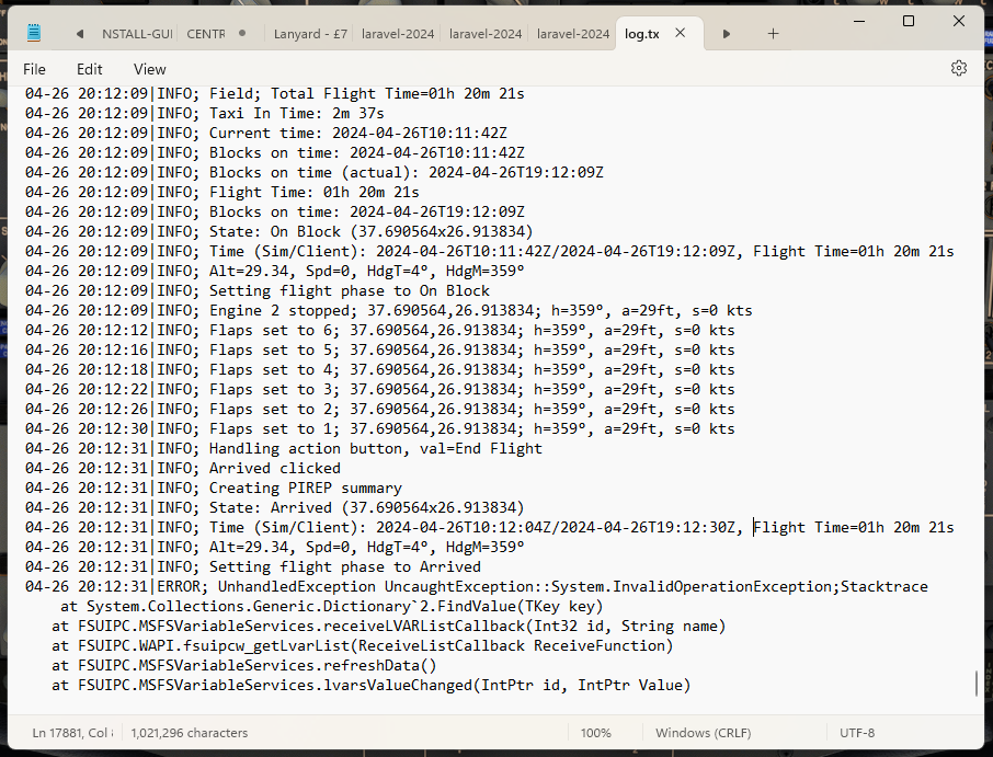
This error is coming from the connection between ACARS and MSFS. You shouldn't have lost your flight progress, though. Which aircraft?

-
It should hopefully be fixed in the next version
-
Do you have logs? Have you tested with/without acars in the same situation? Acars only connects to simconnect, there's nothing running inside of msfs. What other addons are you running?
-
I think I put in there how much time they were stopped as a field? If not, I think I can add that pretty easily
-
Can you DM me on Discord or DM me your IP address here?